AKARI 遠赤外線全天サーベイマップ
概要
説明
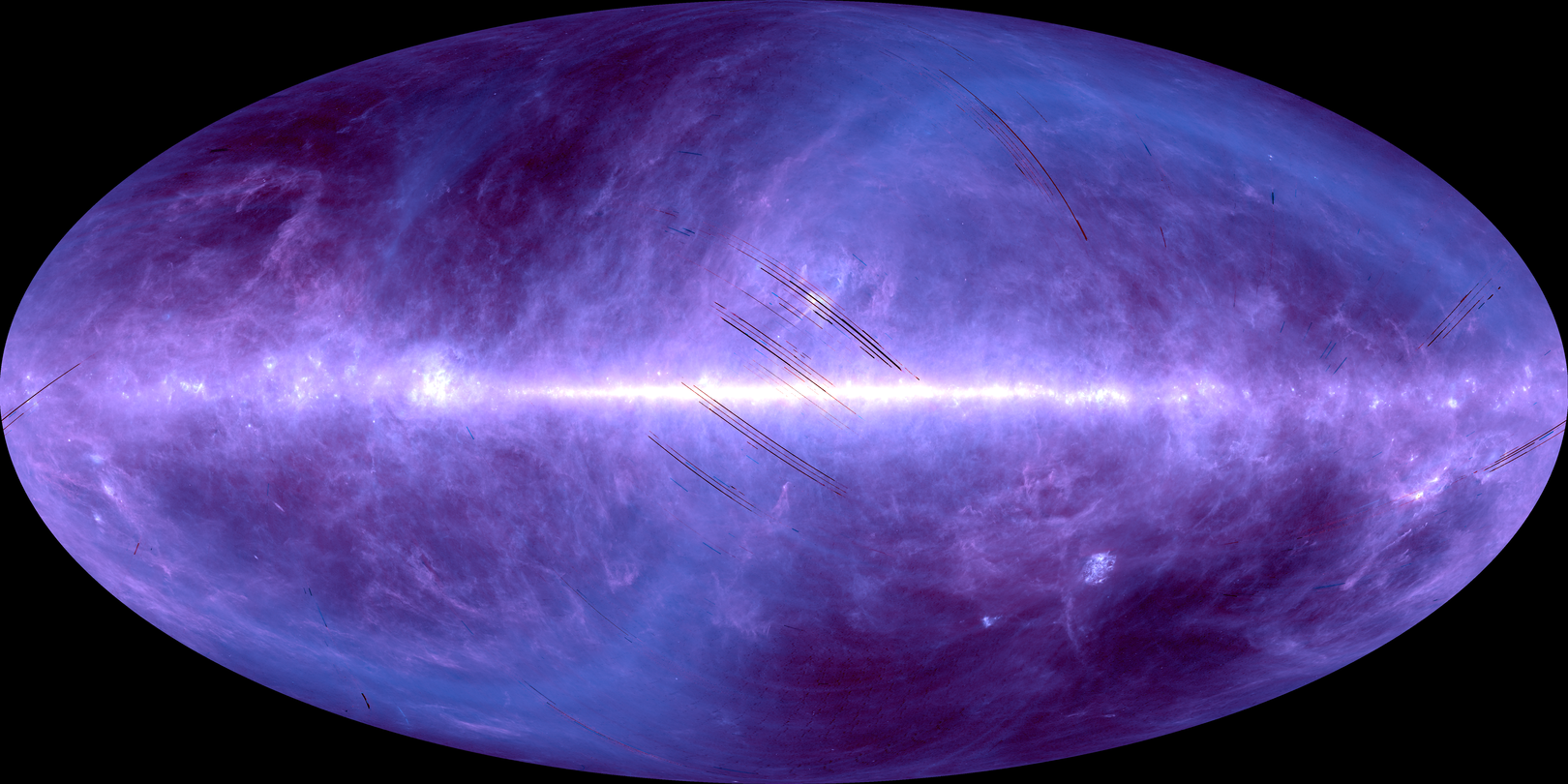
All-Sky image maps at four far-infrared wavelengths at N60 (65 μm), WIDE-S (90 μm), WIDE-L (140 μm), and N160 (160 μm) by FIS, covering area over 99 percent of the entire sky.
Request for using this data
When publishing AKARI data in a journal or proceedings, you are requested to include the following acknowledgement as a footnote to the title of your paper;
“Based on observations with AKARI, a JAXA project with the participation of ESA.”
or in the acknowledgement:
“This research is based on observations with AKARI, a JAXA project with the participation of ESA.”
And please refer to the relevant papers of the AKARI mission, the instrument(s) and software you use for your research.
バージョン
version 2.1
公開日
2014-12-19
時間範囲
from 2006-05-08 to 2007-08-26
識別子
- タイトル: AKARI 遠赤外線全天サーベイマップ
- ID: darts:akari-fis-image-allsky-map-2.1
- URL: https://darts.isas.jaxa.jp/datasets/darts:akari-fis-image-allsky-map-2.1
データ配布
作成者
- AKARI data processing and analysis team (あかりデータ処理・解析チーム)
- ISAS > Institute of Space and Astronautical Science (宇宙科学研究所) [ROR: 034gcgw60]
著作権者
- JAXA > Japan Aerospace Exploration Agency (宇宙航空研究開発機構) [ROR: 059yhyy33]
- ISAS > Institute of Space and Astronautical Science (宇宙科学研究所) [ROR: 034gcgw60]
ライセンス
参考文献
- Doi, Y. et al. (2015) Publications of the Astronomical Society of Japan - he AKARI Far-Infrared All-Sky Survey Maps https://doi.org/10.1093/pasj/psv022
- Takita, S. et al. (2015) Publications of the Astronomical Society of Japan - Calibration of the AKARI Far-infrared All Sky Survey Maps https://doi.org/10.1093/pasj/psv033
関連データ
graph LR
classDef this fill:#ffa23e
darts:akari-fis-image-allsky-map-2.1["AKARI 遠赤外線全天サーベイマップ"]:::this
click darts:akari-fis-image-allsky-map-2.1 href "/datasets/darts:akari-fis-image-allsky-map-2.1"