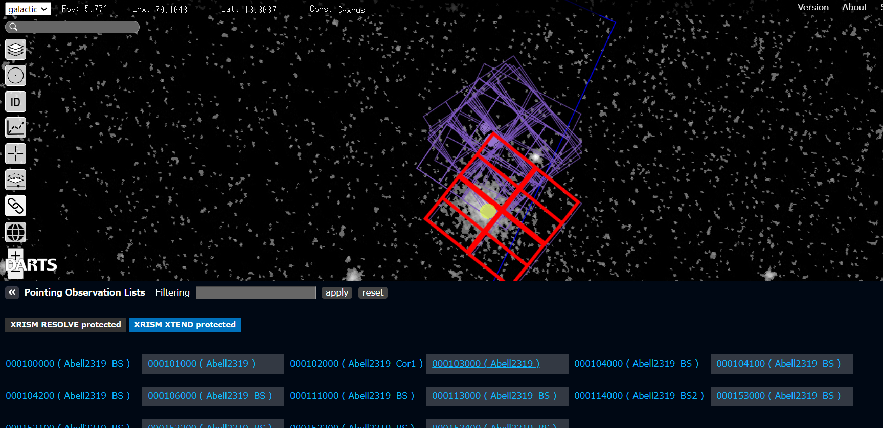
ISS-IMAP Data


Data directory

Extreme Ultra Violet Imager (EUVI)

EUVI_LOS

Line-of-sight data file.
It contains the information of the line-of-site vector for each EUVI pixel, and location of the International Space Station (ISS).

EUVI_loc

Location data file.
It contains the information of the coordinates of the location where each EUVI pixel observed, and location of the ISS. The altitude of the emission layer of the ion resonant scattering is fixed.

EUVI_t_point

Tangential point data file.
It contains the information of the coordinates of the tangential point of EUVI’s line-of-sight (LOS). The tangential point is the location that has the lowest altitude along the line from EUVI in the direction of LOS. Location of the ISS is also included in the file.

Visible-light and Infrared Spectrum Imager (VISI)

VISI_LOS

Line-of-sight data file.
It contains the information of the line-of-site vector for each VISI pixel, and location of the ISS.

VISI_loc

Location data file.
It contains the information of the coordinates of the location where each VISI pixel observed, and location of the ISS. The altitudes of the emission layer of the airglow/aurora and background are fixed.

Last Modified: 05 January 2021